3D Terrain Modeling Software

Drawing a site plan with different terrain elevations is quick & easy with Cedreo.

Complete Terrain Design in 20 Minutes

Cedreo software is the complete tool to easily design a finished lot and house layout.

2D Terrain Plan

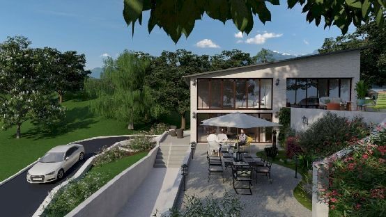
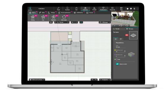
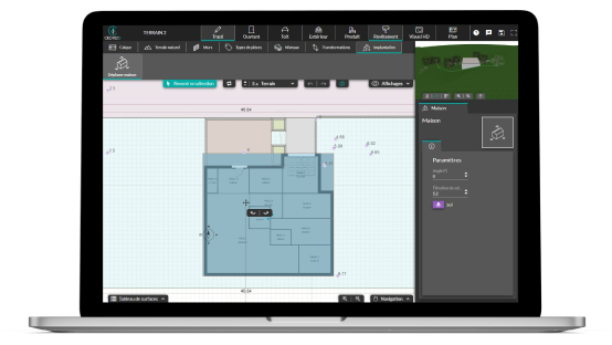
Draw the natural terrain in 2D as described by the surveyor and modify it to design the finished terrain and landscape. Import the plot plan ot the surveyors plan, use it as a layer to start modeling the plot and the areas of the finished terrain.

sloped terrain 09

3D Terrain Model

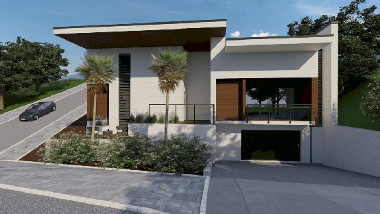
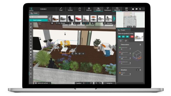
To simplify the design process and increase efficiency, visualize your terrain in 3D while you draw in 2D. At each stage of the layout process, a 3D visualization window allows you to control the layout. Complete the terrain modeling, modify, customize the surfaces and landscaping, and generate 3D renderings in minutes.

sloped terrain 10

Ground Plan

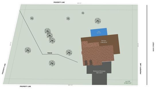
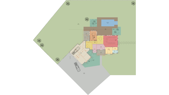
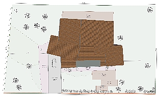
After designing the finished lot, Cedreo allows you to generate a scaled ground plan of the project in a few clicks by adding setback lines and the layout of the building. Automatically calculate the total area of the lot, the footprint, and the open space.

site plan modern 09

Define the Terrain Areas

Use the features of the “Exterior” steps to define the terrain areas in a few clicks.

  • Import of the land plan or surveyor plan
  • Trace the plot in a few clicks
  • Manage the terrain elevation points
  • Draw finished land areas: vegetation, parking, patios…
  • Choose between 2 types of elevation: flat or custom elevations
  • Manage straight and curved paths
  • Automatic curbs and borders
  • Automatic cuttings and fills
  • Earth retention: embankments and retaining walls
  • Land delimitation: hedges and low walls
  • Vegetation zones
Request a demo
definir zones de terrain

Lay Out the Land in 3D

Cedreo makes designing a plot of land easy. Save time by intuitively planning and instantly visualizing your project in 3D.

Show the finished lot with materials and a complete layout. Select materials from a large library of coverings, bricks, facings, plaster, tiles, paving stones, deck boards, gravel, and more. For complete customization of your project, design it by choosing from the over 3,000 3D objects in the Cedreo library: outdoor furniture, plants, property lines, carport, shelters, and more.

Learn more about 3D design
aménager le terrain en 3D

Add the House to the Finished Lot

Cedreo is the top architecture software for construction and renovation professionals. Draw plans of your house projects in 2D, 3D, and modify the layout on the ground plan.

  • Draw a simple and intuitive house plan
  • Draw in 2D, view simultaneously in 3D
  • Change the position of the house: move or rotate the house on the plan
  • Modify the elevation of the finished floor
  • Adjust the terrain zones according to the position of the house
  • Frame automatically follows terrain elevations
Learn more about site plans
positionner la maison surle plan de terrain

Generate Realistic 3D Visualizations

Help your customers plan their future by presenting a complete home project with 3D exterior visuals. Cedreo’s 3D modeling features all you need to easily draw in 3D and simulate a finished lot model with a complete land layout.

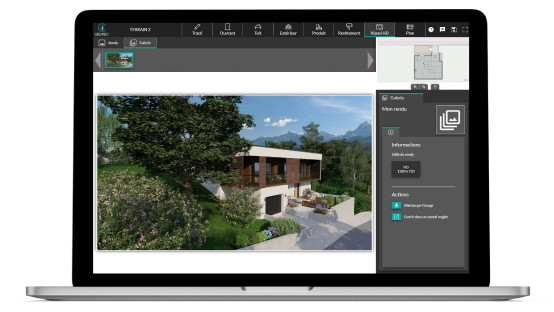
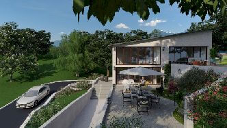
Offer your customers complete immersion in their construction or renovation project. Position the camera on the site to choose a viewing angle and generate photorealistic visuals of the finished and landscape site with the building structure. Cedreo is an easy-to-use and 100% online software for fast 3D images, no matter what computer you use.

Learn more about 3D Renderings
creer des rendus 3D sur terrains en pente avec murs de soutenement

Time-saving Features for 3D Terrain Modeling

When used as a site plan software, Cedreo’s features are designed to speed up the design phase and allow construction and renovation professionals to provide their clients with a complete project proposal including house plans, site layout, finished lot model, site plan, and project cost estimates.

Import de plan

Import the plan

Import the land plan for the surveyor’s plan in PDF, JPEG, or PNG format and use it as a layer to gain precision and efficiency.

2D et 3D

2D & 3D

Your project comes to life in 3D as you draw in 2D. To help with the design process, both 2D and 3D views are displayed simultaneously in your Cedreo space.

Altimétrie

Elevation

Easily manage sloping terrain or differences in level by adding elevation points to the terrain.

talutage

Embankment

Add automatic sloping to your projects. Change the slope or shape of the slope by moving or adding points

Murs de soutènement

Retaining Walls

Automatically manage retaining walls: add retaining walls, modify their thickness and height, and define the type of retaining wall: horizontal or following the slope of the land.

aménagement 3D

Outdoor Design

Model the finished lot with every detail by adding exterior coverings adapted to your client’s project, and by designing the exterior in 3D: pool, outdoor furniture, lighting, etc.

Impression des plans à l’échelle

Print Plans to Scale

Download the floor plan in PDF format and print it to scale in different formats by customizing the orientation and size of margins.

Tableau de surface

Surface Area Table

The surface table is generated automatically and can be downloaded with the surfaces of the house projects and all surfaces related to the land (total area, ground surface, open area).

Partage de plans

Share Plans

Ideal for teams working on a variety of plans or for sharing projects with a design team. Your plans are stored in Cedreo, ready to be shared and modified at any time.

Examples of Terrain Models with Cedreo

Use Cedreo online software for terrain design and modeling. It’s quick and easy to learn, regardless of the type of project.

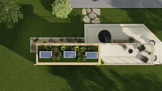
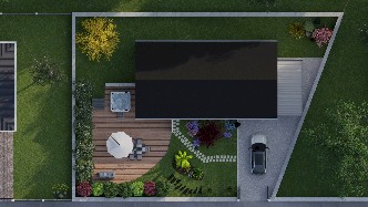
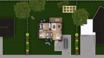
2D site plan with landscaping generated with Cedreo

House plan on a slope

3D tiny house site plan designed with Cedreo

House plan on narrow lot

3D terrain

Land plan with house

sloped terrain 10

House plan with basement

sloped terrain 09

Finished lot with exterior landscaping

modelisation terrain

Landscape modeling

siteplan view

3D terrain map

Landscape site plan example

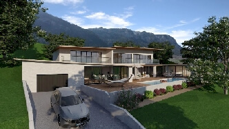
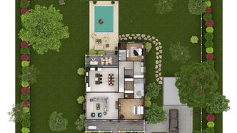
Land with pool

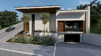
3D rendering of house on slope

It’s easy to use. You can always count of Cedreo’s support for an even faster learning curve.

Because you can always save time and do more.

Our users say it best…

“Cedreo helped us increase the output of renderings, decreasing overall cost of labor per customer”

Sebastjan S. CEO

“It’s a great option for rapid models and realistic images of construction.”

Antton E. Architect

Get started and save time!

See Pricing Plans