For professionals in landscape design, a comprehensive landscape plan forms the foundation of every successful project. A scaled drawing of the entire property helps landscape architects and designers transform ideas into reality, guiding the process from concept through installation. Every element of the development, from the front yard to elaborate garden features, must be carefully documented to ensure success.
Understanding Professional Landscape Site Plan Design
The landscape design process has evolved significantly, requiring landscape architects to determine the best approach for each unique layout. A winning design must account for everything from soil composition to property lines, creating a reference point for all project stakeholders. A thorough landscape plan helps clients understand the design intent while providing crucial details about materials, plants, and paved surfaces.
Essential Components of Landscape Architecture Site Plan
Professional landscape design begins with creating a detailed base map that serves as the foundation for all subsequent development. This crucial first step involves importing or creating a scaled drawing that captures every existing feature of the site. Smart tools allow designers to quickly trace property boundaries and establish the precise positioning of current structures, while terrain visualization layers help represent existing topography accurately.
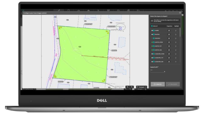
The base map must include comprehensive documentation of all site conditions that will impact the design process. This includes mapping underground utilities, documenting soil conditions, and recording existing drainage patterns. Software enables designers to create multiple layers within their base map, allowing them to toggle between different types of site information efficiently.
When establishing the initial layout, professionals can utilize intuitive drawing tools to outline zones for different purposes. The process naturally flows from broad strokes to precise details:
First, designers establish major spatial divisions:
- Primary use zones (active vs. passive areas).
- Circulation patterns and access points.
- Views and sight lines to preserve or enhance.
- Required setbacks and easements.
Next comes the detailed development of each zone:
- Optimal locations for new plants and trees based on growth patterns.
- Strategic placement of hardscape elements and paved surfaces.
- Integration points between existing buildings and new features.
- Grading requirements and drainage solutions.
Advanced visualization capabilities allow designers to view their work from multiple perspectives simultaneously. As they draw in 2D, they can instantly see how changes affect the three-dimensional reality of the space. This real-time feedback helps ensure that the design intent translates effectively from paper to reality.
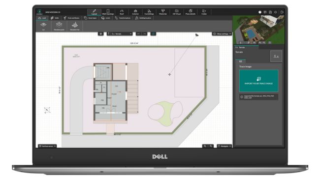
The process requires meticulous attention to technical details while maintaining a holistic view of the project. Designers must consider how each element relates to the others:
- How plant selection affects maintenance requirements.
- Where shade patterns impact material choices.
- How elevation changes influence circulation patterns.
- When existing features can be repurposed effectively.
By leveraging site plan software, professionals can create comprehensive landscape site plans that serve multiple purposes:
- Construction documentation for installation teams.
- Presentation materials for client approval.
- Reference documents for regulatory compliance.
- Maintenance guides for long-term care.
Want to see Cedreo facilitate these tasks in realtime? Check out this webinar
[Replay Webinar] Draw terrain quickly and easily
Advanced Landscape Site Plan Design Elements
Modern landscape design requires careful attention to both natural and constructed elements.
When developing a layout, professionals must consider both the big picture and intricate details. The process includes:
- Sustainable design practices that support long-term success.
- Strategic plant selection based on soil conditions.
- Installation planning for hardscape elements and paved surfaces.
Homeowners want outdoor spaces that combine beauty with functionality, landscape architects must determine how to create spaces that work in all conditions, from full sun to complete shade. The final design should seamlessly integrate sidewalks, garden areas, and architectural features.
Technical Precision in Development
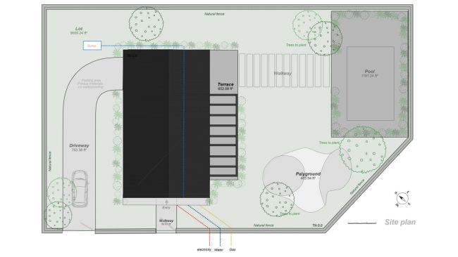
Housing professionals understand that the design process requires meticulous attention to detail. They must determine proper plant placement, outline construction sequences, and create reference documents for contractors. The proc’ess involves careful analysis of existing features, including some of those listed above – for instance:
- Soil composition and drainage patterns.
- Property lines and setbacks.
- Light and shade patterns throughout the yard.
Creating Dynamic Outdoor Environments
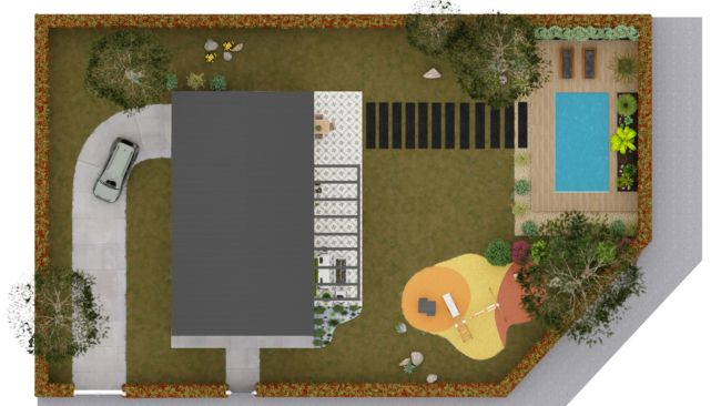
Precision can’t be the only goal – the most skilled pros know how to balance aesthetic appeal with practical functionality. The design process includes evaluating yard conditions, selecting appropriate materials for paved surfaces, and creating spaces that enhance the entire property. Every element, from simple garden beds to complex water features, requires careful consideration during development.
Implementation Planning
A well-executed landscape site plan facilitates smooth project installation. When contractors or home builders create spaces according to a detailed layout, contractors can accurately determine material needs and establish clear project timelines. The process requires careful coordination to ensure all elements, from paved surfaces to plant selection, work together harmoniously.
Professional Tools for Modern Landscape Site Plan Design
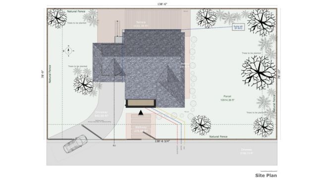
Success in landscape site plan design requires both creative vision and technical precision. Professional software helps landscape architects create reference documents, visualize concepts, and develop comprehensive site plans. Modern tools streamline the entire process, from initial outline to final design, ensuring that every aspect of the project meets both technical requirements and aesthetic goals.
Craft a Winning Landscape Architecture Site Plan
Creating professional site plans requires powerful, intuitive tools that streamline the entire process. Cedreo’s comprehensive platform enables designers to create sophisticated site plans and stunning 3D visualizations in under two hours. The software’s terrain modeling capabilities allow professionals to quickly draw accurate representations of any yard or property, while its extensive library of materials and plants ensures realistic final designs.
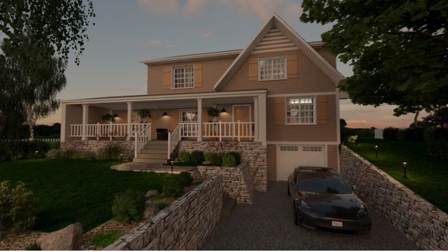
When working with Cedreo to create spaces and develop landscape plans, professionals can:
- Model terrain features and outline property boundaries in under 20 minutes.
- Import existing plot plans as reference layers for efficient development.
- Access thousands of plants, trees, and materials for realistic visualization.
- Generate instant 3D renderings to showcase design intent.
Streamlined Workflow for Professional Results
Cedreo’s intuitive interface helps streamline the design process from initial layout through final installation. The software enables professionals to determine optimal plant selection based on soil conditions and light patterns, while powerful visualization tools help clients understand how paved surfaces and garden features will look in both full sun and shade conditions.
The platform’s presentation capabilities ensure that every landscape site plan can be effectively communicated to stakeholders. From scaled drawings of the entire property to photorealistic 3D renderings of the final design, Cedreo provides the tools needed to showcase projects professionally.
Professional Presentation Strategies
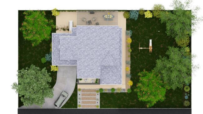
Converting technical drawings into compelling client presentations requires sophisticated documentation tools. Modern presentation capabilities enable professionals to:
- Generate comprehensive project portfolios that include both landscape site plans and floor plans
- Create scaled drawings that clearly communicate construction details
- Produce photorealistic 3D visualizations from multiple viewpoints
- Develop custom-branded presentation documents that reflect professional standards
The ability to present projects through multiple visualization methods helps clients fully understand design intent. By showing how landscape elements relate to the home’s architecture through both technical drawings and realistic renderings, professionals can more effectively communicate their vision and secure project approval.
Wondering how this is all accomplished? Let’s cover how terrain modeling in landscape design brings a vision to life.
Mastering Terrain Modeling in Landscape Site Plan Design
A crucial aspect of professional design lies in accurate terrain modeling and representation. The design process must account for natural topography when determining how to create spaces that work with what’s already there. Contractors, landscape designers and home builders need sophisticated tools to draw and model terrain effectively, ensuring the final design harmoniously integrates with the natural layout of the entire property.
Cedreo’s terrain modeling capabilities enable professionals to create accurate representations of both natural and finished terrain in under 20 minutes. The process begins with establishing elevation points to represent the existing topography, which becomes the base map for further development. This scaled drawing serves as the foundation for all subsequent design work.
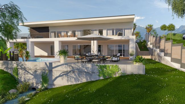
Natural Terrain Representation
The initial phase of terrain modeling focuses on accurately capturing existing features. Professionals can:
- Define elevation points based on survey data.
- Import terrain visualization layers as reference material.
- Position buildings precisely within the topographical context.
- Determine optimal orientation based on natural slope.
Finished Terrain Design
Once the natural terrain is established, landscape architects can develop the finished landscape plan. This process includes:
Creating defined spaces for various uses:
- Paved surfaces for parking and gathering areas.
- Garden zones with appropriate soil preparation.
- Pathways that work with natural grade changes.
Managing elevation transitions through:
- Strategic placement of retaining walls.
- Natural-looking embankments.
- Terraced garden designs.
- Integrated drainage solutions.
Site Plan Customization
The final design process includes detailed customization of the site plan to ensure clear communication of design intent. Professionals can:
- Specify materials for all paved surfaces.
- Indicate plant selection for each garden zone.
- Document drainage patterns and soil conditions.
- Create detailed installation references.
From Concept to Completion
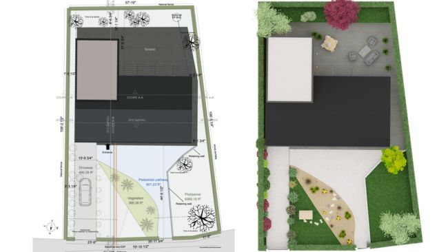
With Cedreo’s comprehensive terrain modeling capabilities, housing professionals can easily move from initial concept through detailed development.
Moving Forward with Professional Design
The future of landscape site plan design lies in combining technical expertise with creative vision. When landscape designers effectively integrate both traditional design principles and modern development techniques, they create spaces that exceed expectations. Professional site plan software helps streamline the process from initial layout through final installation, ensuring that each element of the project achieves its intended purpose.
By leveraging professional tools and maintaining focus on both practical requirements and aesthetic excellence, today’s landscape design professionals can create reference documents that guide successful project implementation.

